With a $3000 investment, a little bit of patience and a lot of ingenuity, the City of Launceston has revolutionised its approach to the spatial and investigations area.
After reviewing the needs of its spatial and investigations unit and the customers they serve, the City purchased a DJI Phantom 4 Advanced drone with survey-grade GPS about a year ago.

Cory Robson, the City’s Spatial and Investigations Manager, says the drone has now become the team’s go-to tool for GIS mapping, surveys, inspections of hard-to-reach assets and high-resolution images.
“It’s amazing – the benefit compared to the cost is unreal,” Robson says.
He says the drone almost paid for itself in its first use. Aside from the initial $3000 outlay for the drone, Robson says the only costs the City has shouldered are purchasing additional batteries and software called Drone2Map, which stitches individual photos captured by the drone into a complete high resolution or 3D image.
“We have a waste transfer station at the landfill site – surveys were costing between $6000 to $10,000. Now we’re doing that ourselves, and the drone didn’t even cost half of that,” he says.
“In the first couple of flights we’ve made our money back. I can’t even tell you how many times we’ve used it and the time saving it’s created for us.”
That time saving has been particularly evident when the team needs to conduct condition assessments of tide flaps along flood levees.
“We’ve got a lot of outfall stormwater networks that are pumped, but have a significant number of gravity fed lines that have tide flaps on the other. So, to be able to inspect those we’d always have to get in a boat and get right up amongst the pipes to see if that tide flap is clear prior to a weather event,” Robson explains.
“Now, we use the drone to fly right down in and have a look around the actual outfall pipe and around, looking for any debris holding that tide flap open.”
Robson says the ability to pre-program flights back in the office makes using the machine even easier and removes a lot of the risk. Using this function, the City was able to cut the time needed to create a digital terrain model (DTM) from three days to just two hours.
“It may take two surveyors up to three days of doing a full DTM for the engineering and design department, so they can redesign the corners and roads,” Robson says.
“Well, that three-day period is cut down to about two hours, because you can do a full DTM automated flight; it takes 12 to 15 minutes to do each corner, which would normally be very labour intensive, and then the data would need to be processed and put into CAD software to supply the right information.
“With the drone, you can just fly it over, process that imagery through the Drone2Map program, and it gives you a full, DTM that you can put into your CAD.”
In addition to saving time, the drone also picks up far more points than a manual survey can.
“Where you would generally pick up 1000 points by hand over a one acre property, you can fly your drone over and pick up hundreds of thousands of points,” Robson says.
“It definitely improves efficiency.”
Another use for the drone, which Robson anticipates will expand in the future, is 3D modelling. So far, the drone has also been used by the survey team for 3D modelling of buildings, 3D modelling for landfill sites to calculate volumes and to monitor land slips.
Communication
Another area where the drone has proved invaluable is keeping the community informed about the progress of ongoing projects.

“Our council has been really good at keeping the public up to date with projects – we utilise Facebook as a communication tool. Any little update on a project, we try beforehand to get footage with the drone and upload it to Facebook,” Robson says.
Robson says the community’s response is generally far more positive when the communication is reinforced by fascinating drone footage and images.
“I think it gives more transparency if people can see the image and see right down in the building site. If they’re following that project with interest, if they’re kept in the loop and you give them photos, videos and you’re answering their questions, you’re closing the loop and not leaving them hanging,” he says.
“They feel like they’re part of the works; it’s not just council going and doing what they want to do, it creates ownership of those projects if they’re kept up to date.”
Training
Robson says drone operation training has been shared across the Spatial and Investigations team.
“Training for the team is mainly onsite group training – a couple of the team go out, and we’d get used to flying it manually in a big open field, and just get used to the basics of a drone,” he says.
“Drone technology has come a long way even in the last 12 months, with handling and crash avoidance – the drone we have has crash avoidance so it’s pretty hard to crash it into a tree or a building. We wanted to lower the risk as much as possible.”
Patience IS a virtue
Robson’s most important tip from City's experience is to persevere, even if the initial results aren’t up to scratch.
“There was a bit of a learning curve early on to be able to work out what software works for us,” he says.
“Patience is the key – originally when we got the drone, there wasn’t a lot of information out there, like tips on how to use the Drone2Map. There’s always lots of little tweaks. I’ve got two guys here that I gave the time to learn that software. Sometimes things don’t work, but just go back and give it another crack. We’re finding now that if we have any niggling issues, we can fix everything,” he says.
“Don’t give up, keep going.”
As the City’s proficiency with the technology has increased, so too has the uses for it.
“We now have people coming to us and asking for things that we didn’t even think of – they can see what we’ve done with it, and they can see what it can provide, and they’re thinking of new applications,” Robson explains.
“Once you educate people in what it can do and the benefits, you won’t look back. It’s really been ramping up in the past five to six months, now we’ve got the hang of it, and we can see how good it is. Considering the end result, what it can provide and how easy it is once you know how; I wish we had this 10 years ago!”
If you would like more information, the City of Launceston is happy to assist. Please contact Cory Robson at Cory.Robson@launceston.tas.gov.au.
Image 1: Engineering Surveyor Steven Harvey about to undertake a survey.
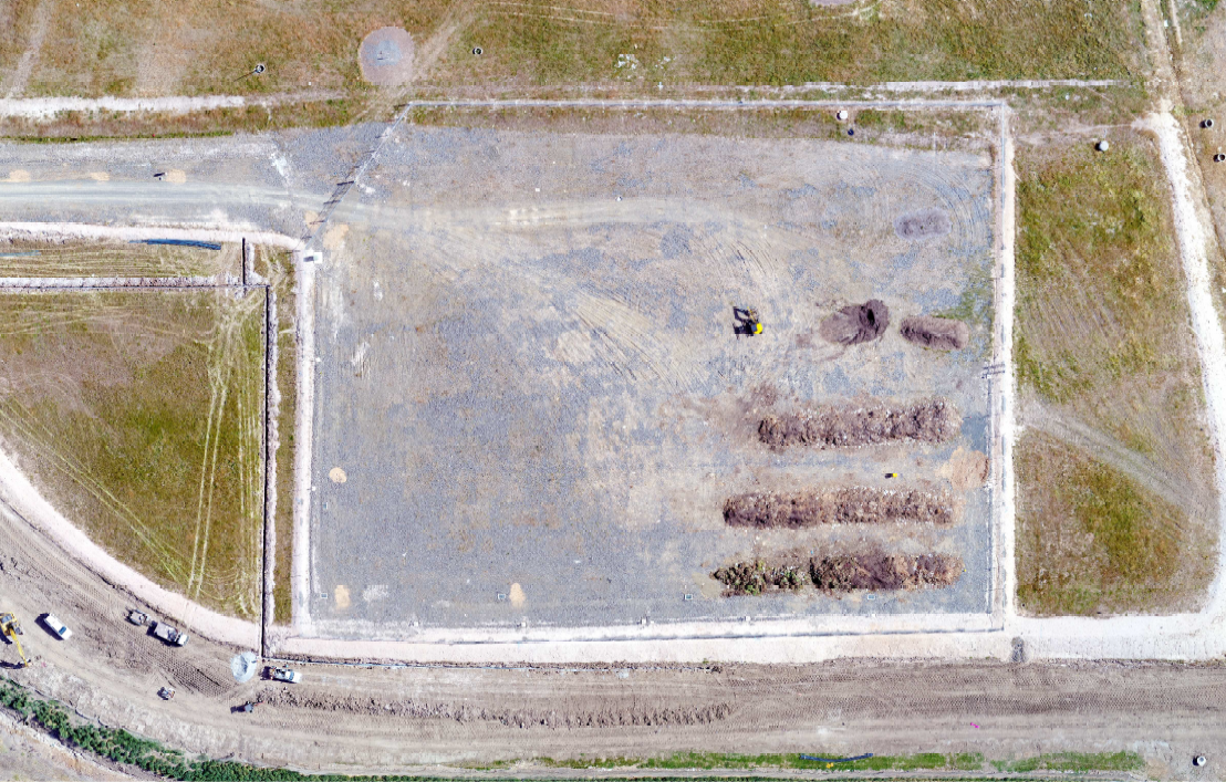
Image 2: Drone image of a green waste site
Image 3: Drone image of a Boral site